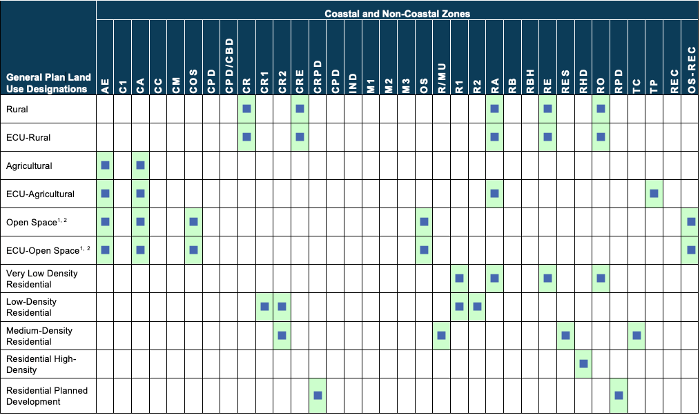
The County shall ensure that zoning classifications are consistent with the General Plan Land Use Diagrams (Figures 2-4 and 2-5) and the General Plan Land Use Designations and Zoning Compatibility Matrix (Table 2-1). The County shall apply the following factors to determine the appropriate zone classification (from among those consistent with the appropriate land use designation):
- Recognizing the desirability of retaining existing uses and densities on the subject land;
- Recognizing the desirability of accommodating anticipated uses on the subject land;
- Maintaining continuity with neighboring zoning, land uses and parcel sizes;
- Implementing the recommendations of specific zoning and land use studies of the area in question;
- Recognizing and addressing the presence and significance of resources and hazards; and
- Evaluating the ability to provide public services and facilities.


